
Best Motorcycle Roads in Arizona
Arizona doesn't hand you one kind of riding — it hands you five. You can start a morning run in Sonoran Desert heat, climb through oak woodland, and top out in ponderosa pine at 9,000 feet, all on the same tank of gas. The roads here range from a National Scenic Byway threading a slot of red rock along Oak Creek to a remote two-lane with 460-plus named turns and not a guardrail in sight. The state's elevation range is what makes it work: when the desert floor turns brutal in summer, the White Mountains and sky islands stay genuinely cool. That same geography is also what makes planning matter — fuel gaps run long, monsoon storms arrive fast, and a few roads close seasonally. Do the homework beforehand and Arizona rewards you with some of the most varied pavement in the American West.
- Routes
- 1
- Best season
- Feb–May and Oct–Nov
- Helmet law
- Required under 18 only
- Lane splitting
- Illegal; filtering legal (stopped traffic)
- Terrain range
- Desert to 9,300 ft alpine
The routes
Why Arizona Rewards the Prepared Rider
Arizona is genuinely one of the most geographically diverse riding states in the country. The routes here aren't variations on a theme — they're different worlds stacked on top of each other. A sky island highway climbs 6,000 feet through five distinct climate zones in under 30 miles. A canyon corridor drops 2,000 feet into the earth and then climbs back out into the White Mountains. A remote two-lane runs 123 miles with almost no traffic, no guardrails on significant drop-offs, and one fuel stop in between. Understanding that range is the starting point for planning any trip here.
Choosing the Right Route for Your Trip
Elevation and time of year should drive your decision more than any other factor. The desert-floor routes — and the lower reaches of Oak Creek Canyon and Salt River Canyon — are ideal from fall through spring. High-elevation roads like the Coronado Trail's northern section and the upper portions of the Mt. Lemmon Highway shift their optimal window to late spring through early fall. If you're visiting in summer, the high country is your friend; the desert floor can be genuinely dangerous in triple-digit heat.
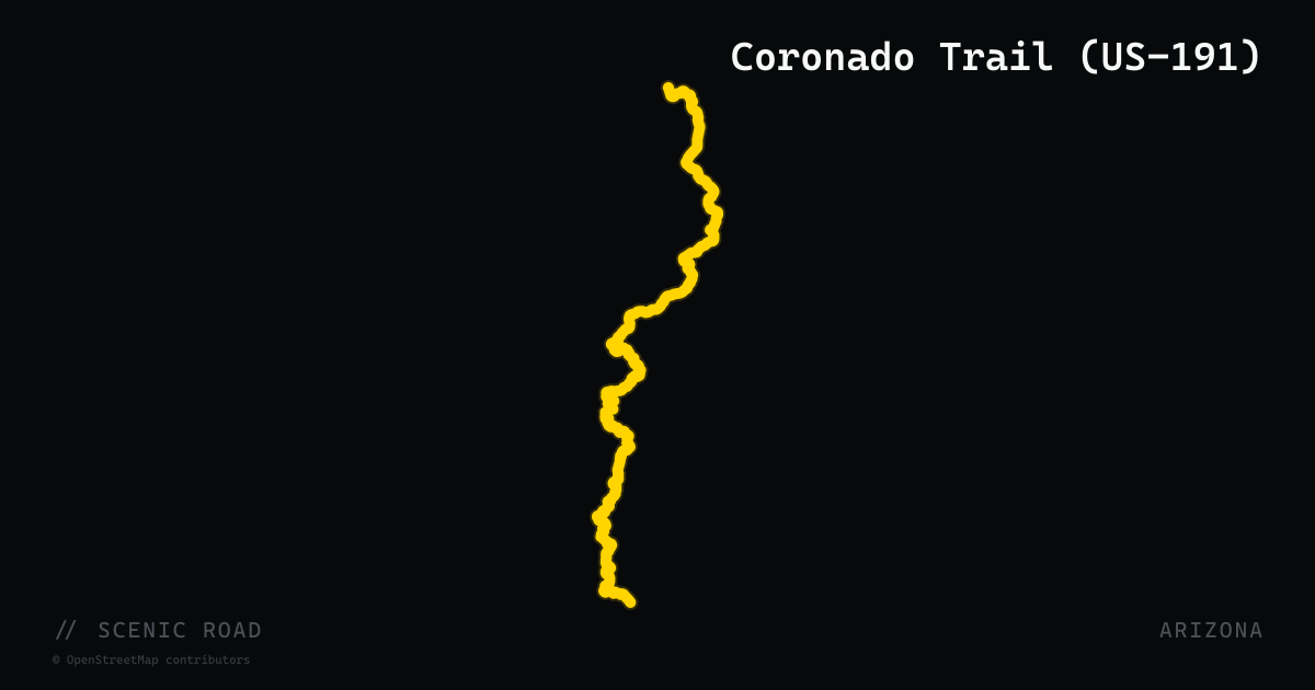
Skill level matters too. The Coronado Trail is demanding for any rider — tight posted corners, long fuel gaps, no services, and significant exposure on drop-offs make it a route that rewards honesty about your abilities. Salt River Canyon and Oak Creek Canyon are more accessible but still require attention, especially in traffic around Sedona on weekends. The Arizona BDR is a multi-day adventure-bike route, not a day ride.
Practical Hazards to Know
- Monsoons: Mid-June through mid-September, afternoon storms can produce flash floods in canyon corridors with almost no warning. Check forecasts before entering any canyon route during this window.
- Wildlife: Deer, javelinas, and cattle are genuine road hazards, particularly at dawn and dusk on rural routes.
- Heat and dehydration: Carry more water than you think you need. Desert heat at altitude is deceptive.
- Fuel planning: The Coronado Trail and the Arizona BDR both have fuel gaps long enough to leave you stranded. Fill up at every opportunity.
- Construction: ADOT has active switchback repair work on SR 89A through late summer 2026 — check conditions before riding Oak Creek Canyon.
- Sand and gravel: Desert roads collect wind-blown debris, especially after storms. Corners can have sand across them where you least expect it.
Getting the Most Out of a Trip
Many riders base out of Tucson for southern routes and Flagstaff or Show Low for the White Mountains and Coronado Trail. These towns put you within reasonable range of multiple distinct rides without needing to retrace the same pavement. If you're combining routes, the Salt River Canyon connects naturally to the Coronado Trail — Globe to Show Low to Springerville makes a solid two-day loop with very different character on each leg.
Frequently asked
Do I need to wear a helmet to ride a motorcycle in Arizona?+
Arizona law (A.R.S. 28-964) requires helmet use only for riders and passengers under 18. Adults are not legally required to wear one, but all riders regardless of age must wear approved eye protection — glasses, goggles, or a transparent face shield — unless the motorcycle is equipped with a protective windshield. Wearing a helmet is strongly recommended; foregoing one can also affect personal injury claims if you're in an accident.
Is lane splitting legal in Arizona?+
No. Lane splitting — riding between lanes of moving traffic — is illegal in Arizona. However, lane filtering was legalized in 2022 (Senate Bill 1273). Filtering is permitted only on surface streets with a posted speed limit of 45 mph or less, when all adjacent vehicles are completely stopped, and the motorcycle travels no faster than 15 mph. It is not permitted on freeways.
When is the best time of year to ride in Arizona?+
Late February through early May and late September through November offer the most comfortable conditions statewide. The desert lowlands are also very rideable in winter. Avoid mid-summer in the desert (triple-digit heat is a real hazard) and watch for monsoon storms June through mid-September, which can produce flash floods with little warning, especially in canyon routes.
Are there long fuel gaps on Arizona routes I should plan for?+
Yes — several. The Coronado Trail (US-191) has roughly 90 miles between fuel stops at Clifton and Alpine, and the Arizona BDR has a gap reported at around 136 miles. Fill up before entering either route and carry water; the desert heat makes dehydration a genuine risk, not just an inconvenience.
Are there road closures or construction I should know about?+
As of 2026, ADOT has ongoing switchback repair work on SR 89A (Oak Creek Canyon) through at least late summer 2026 — expect possible delays or lane restrictions near the north-end switchbacks. The Coronado Trail's higher elevations around Hannagan Meadow can be snow-covered or icy from late fall through early spring. Always check ADOT's travel information before heading out on either route.
What kind of bike is best suited for these Arizona routes?+
Most of the paved routes here are rideable on any street bike. The Coronado Trail's 10–15 mph posted corners north of Morenci demand real attention and are tiring on a touring bike — doable, but humbling. The Arizona BDR is mixed-surface and best suited to an adventure bike with off-road capability. For everything else — Oak Creek Canyon, Salt River Canyon, Mt. Lemmon Highway — a sport-tourer, cruiser, or standard all work fine.
When to ride
The widest window for riding across the full state runs from late February through early May and again from late September through November, when temperatures are moderate and the risk of extreme heat or monsoon rain is lowest. Desert-elevation routes near Tucson and Phoenix stay rideable through winter — daytime temperatures can reach the mid-60s — while high-elevation roads like the Coronado Trail north of Morenci and Hannagan Meadow hold snow and may be slick or closed from late fall through early spring. Arizona's monsoon season, roughly mid-June through mid-September, brings afternoon flash flooding and rapidly deteriorating road surfaces, particularly in canyon corridors.
+Sources & references (7)
- Arizona Revised Statutes 28-964 — Motorcycle Equipment (Helmet Law)
- Arizona Revised Statutes 28-903 — Lane Filtering Law
- Is Lane Splitting Legal In Arizona? — TEAM Arizona Motorcycle Training
- Guide to Riding a Motorcycle in Arizona — Riders Share
- Best Motorcycle Rides in Arizona 2026 — Riders Share
- Arizona Motorcycle Helmet Laws — Law Tigers
- Lane Filtering Laws in Arizona — Crime and Injury Law